PHOTO
By NICK STIRLING
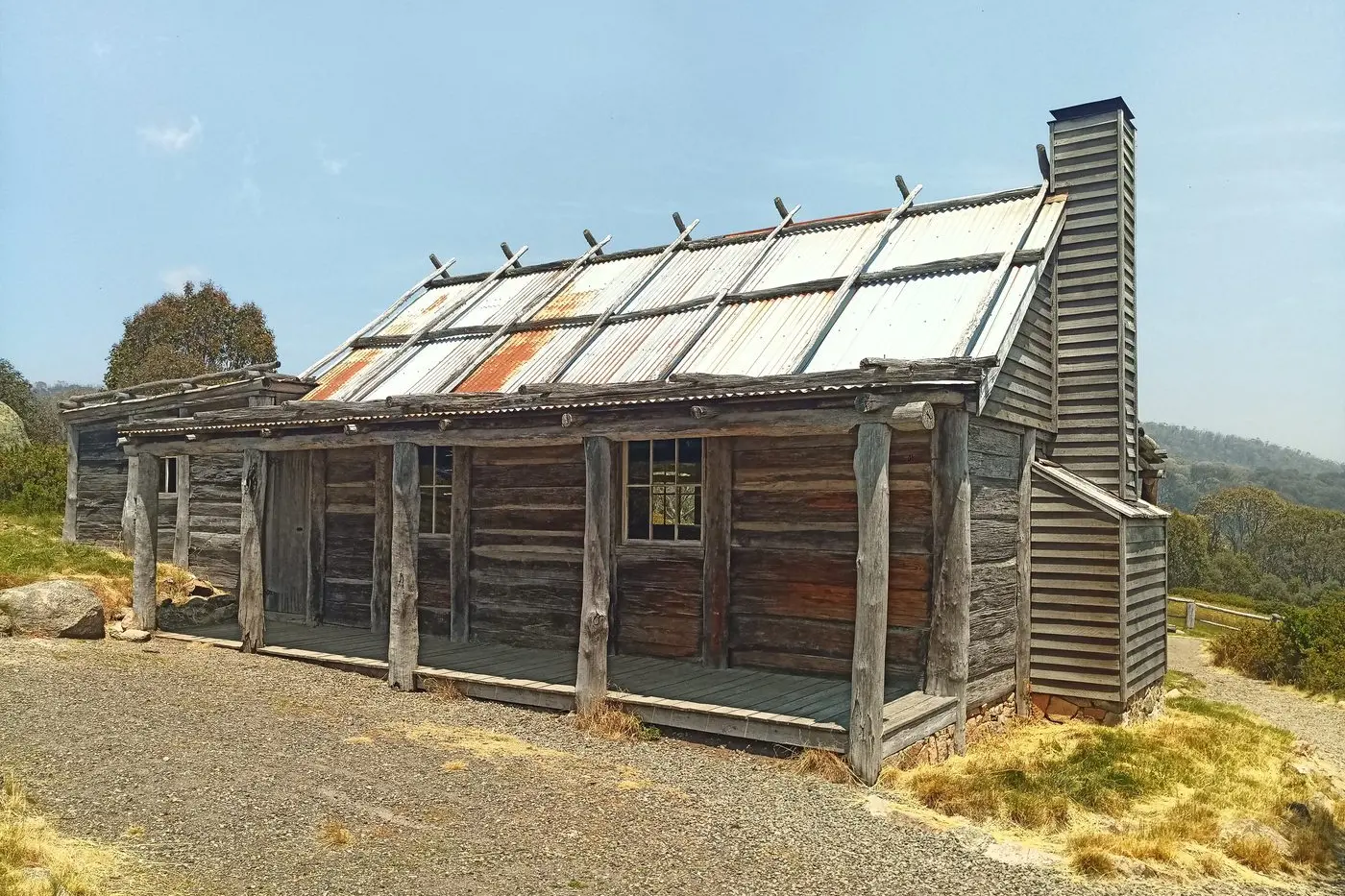
CRAIG'S Hut in a two-wheel drive is no problem as long as you are prepared to walk the last 1.7 kilometres.
You can drive almost any vehicle to the Circuit Road picnic area and park there.
From there, it is a 1.7-kilometre hike which will take around 45 minutes along an easy-to-follow hiking track.
If you can walk up the Punt Road hill, you can manage this hike.
This area is open in summer only and is closed to all vehicles during winter.
Craig’s Hut is located in a natural clearing where a hut was built for The Man from Snowy River movie.
It is a great place to visit, but many people do not go because they think they need a four-wheel drive.
You don’t need one.
When you leave Mansfield, head out along the Mt Buller Road.
As you approach Merrijig, look to your right, and you’ll see Mt Timbertop.
Mt Timbertop has a rocky band about 100 metres from the top, with little vegetation and trees at the summit.
It is easy to recognise and worth noting on your way.
If you watch The Man from Snowy River again, you’ll notice Mt Timbertop in the background of many scenes, giving you a sense of where they were filmed.
Continue to Mirimbah and turn left past the toll gate, heading up to Telephone Box Junction at Mt Stirling.
Follow the signs to Craig’s Hut.
The road is twisty and rocky, so take your time.
You will see a children’s crossing sign just before the Circuit Road picnic area, where you should stop and park.
There is a toilet block and tables and chairs at the picnic area.
The walking track is clearly marked on the opposite side of the road.
It takes about 30 to 40 minutes to walk and is well worth the effort.
About a kilometre past the picnic area is the four-wheel drive track up to Craig’s Hut.
Do not try to walk up the four-wheel drive track; it is steeper and longer than the walking track.
Do not attempt to drive the four-wheel drive track in a two-wheel drive car; the washaways are deep, and you will get stuck.
When you reach the top, you will find the iconic hut and stunning views of Mt Cobbler.
There are picnic tables, fireplaces, a toilet block, and a water tank.
It’s a perfect spot for a picnic or BBQ, provided there are no fire warnings.
Check the water tank before lighting a fire to ensure there is enough water available to extinguish it when you’re finished.
If you have time when leaving, you can continue along Circuit Road, which loops back to Telephone Box Junction.
As you follow it around, you will see a sign for Bindaree Falls.
The turnoff to Bindaree Falls is about 4 kilometres away, with a clearly marked car park and signs for a short walk to the falls.
Bindaree Falls is a low-volume waterfall that flows over a rocky overhang, allowing you to walk almost underneath it.
No matter how hot it is elsewhere, Bindaree Falls is always a cool and refreshing spot.
It’s a short walk of around 50 metres to view and photograph the falls.
If you prefer, you can skip the longer walk to get closer to the falls.
When you return to your car, continue along Circuit Road to Telephone Box Junction.
At this point, it’s quicker to keep going than to return the way you came.
This adventure should take around 4 to 5 hours, and there’s no need to rush.
I still recommend consulting a map before setting off and making your own assessments.
If it has been very wet, road conditions might not be suitable, and there is always the chance of a fallen tree that could require a change of plans.
Be confident and go exploring, but keep making assessments along the way.
If the weather turns bad or you’re not confident driving on dirt roads, you can change your destination and stop at the Mirimbah picnic ground, which has free gas BBQs, tables, and a creek running through it.