PHOTO
55392.0
Access to one of Mansfield Shire’s much-loved swimming spots, the Black Hole at Merrijig, has been questioned by residents, with roadside parking emerging as the main concern.
When the Courier sought clarification, Mansfield Shire Council said the site remains accessible but is not considered a safe or suitable entry point.
In a statement, Council said it “recognises the community’s long-standing interest in accessing the river at the location commonly known as the Black Hole in Merrijig.”
It said that while public access via the Council reserve is available, “this site is not a recommended or suitable access point due to its steep terrain and the absence of safe parking facilities.”
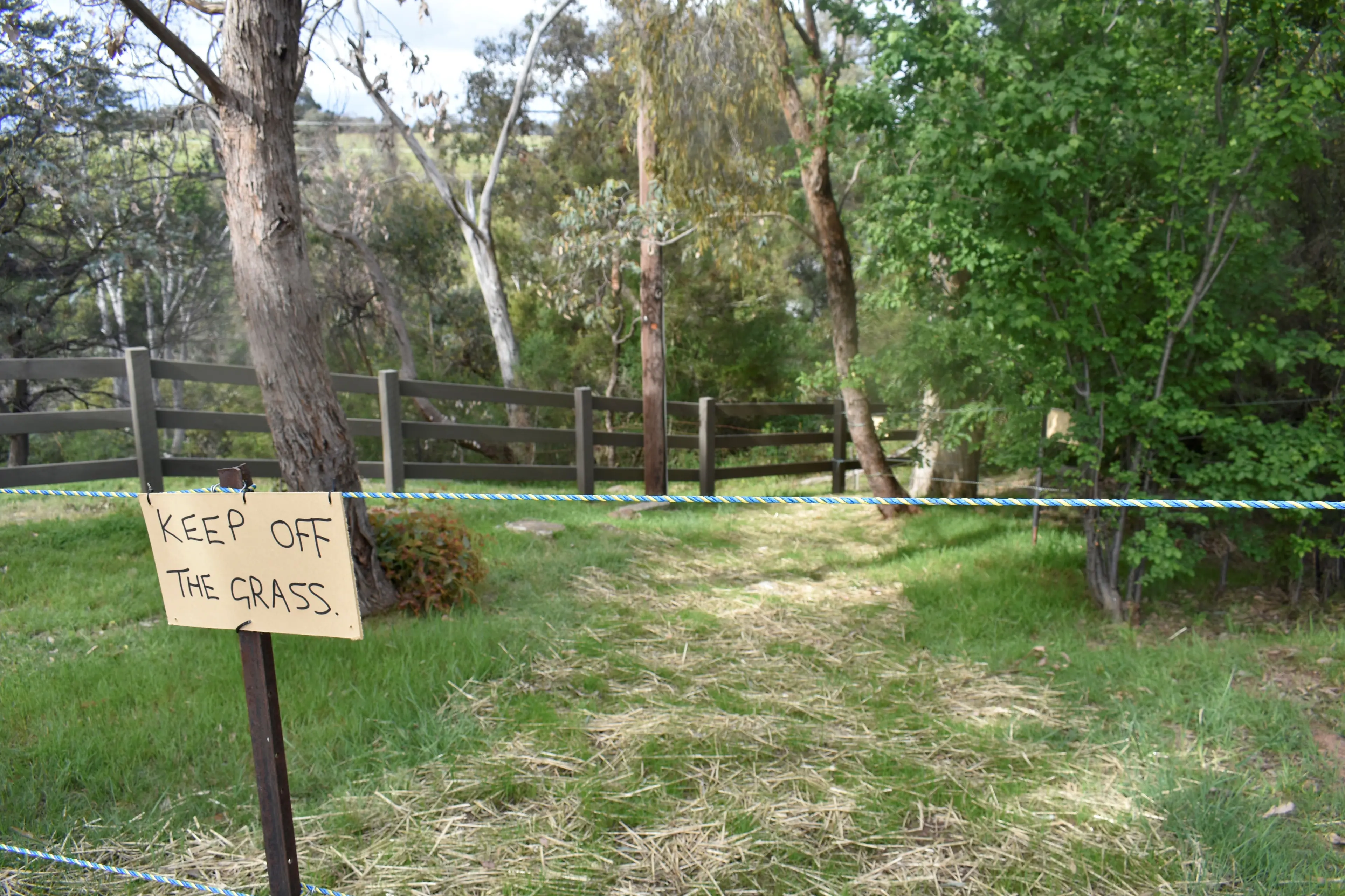
Council said it understands a landholder has installed fencing along sections of the Crown land frontage to support roadside management and grass rehabilitation after long-standing issues with unlawful parking.
According to Council, the fencing “does not restrict lawful public access to the river.”
Residents told the Courier the narrow pathway that remains open is heavily overgrown, and the lack of parking along the bend in Mt Buller Road makes the spot difficult to use.
One resident, who asked not to be named, said the current conditions deter visitors.
“I will show you the access,” they said.
“There is narrow access with very little visibility to it, which deters visitors to this idyllic spot.”
“There is a sign 900 metres down Mt Buller Road from the Black Hole, but with only limited parking access.”
Council reminded residents and visitors to use recognised and signposted river access points where parking and facilities are safer and more appropriate.
It also said vehicles stopping or crossing Mt Buller Road to reach the water pose “significant safety concerns” for motorists and pedestrians.
Road safety and parking management on Mt Buller Road fall under the Department of Transport and Planning, and Council said it is working with the department to identify “safer and more sustainable access options.”
Council said Merrijig’s river frontages are licensed under the Land Act 1958 to adjoining landholders for grazing and land management, and while public recreation is generally permitted, these areas are “not open-access reserves” and are subject to strict licence conditions.
Mayor Cr Steve Rabie said balancing access with safety remains important.
“Merrijig’s river frontages are cherished for their natural beauty and for the recreational opportunities they offer residents and visitors of Mansfield Shire,” he said.
“Council understands the importance of these spots…and it will continue to support safe and responsible public access wherever it is lawful and sustainable.”
“Our responsibility to ensure public safety remains our top priority.”
“Residents and visitors…must respect private property boundaries and ongoing land management activities.”
Council’s guidance to visitors includes using designated access points, parking safely, respecting property boundaries, and following leave-no-trace principles.
Safe access points along the Delatite River include White Hole, Brown Hole, Black Hole (signed access near 2127 Mt Buller Road), the area near the Sebel, Stoney Creek Bridge and three access points along Hearns Road.
Council said it remains committed to supporting community enjoyment of river frontages “in ways that are safe, lawful, and respectful,” balancing public use with environmental and land management responsibilities.